Select an option from the list below to view high resolution images and data about soils across Northern Ireland.
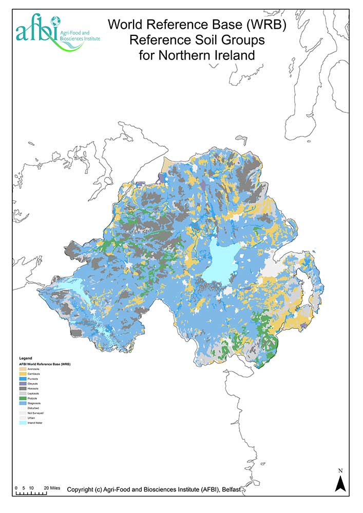
The World Reference Base map shows the locations of the nine reference soil groups recognised in Northern Ireland. It is derived from the general soil map of Northern Ireland at 1:250 000 scale, held by the Agri-Food and Biosciences Institute (AFBI).
For more information on the classification of soils in Northern Ireland, refer to Soil and Environment: Northern Ireland.
The following maps are protected by copyright and their use is subject to a specific licensing agreement between AFBI and the user. Depending on the status of the user, the cost can vary from a fully commercial charge for data lease to being royalty free with a small charge for extraction and preparation of the data to meet the user's needs.
The World Reference Base map shows the locations of the nine reference soil groups recognised in Northern Ireland. It is derived from the General Soil Map of Northern Ireland at 1:250 000 scale, held by the Agri-Food and Biosciences Institute (AFBI). The dominant soil series in each soil group has been correlated to the equivalent Tier 1 Reference Soil Group in the World Reference Base classification system of 2006 as defined in World Soil Resources Report No. 103.
| Title | Soils of Northern Ireland - World Reference Base |
|---|---|
| Source | Agri-Food and Biosciences Institute (AFBI) |
| Enquiries | info@afbi.gov.uk |
| Scale(s) | 1:250 000 |
| Coverage | Northern Ireland |
| Format | GIS point data |
| Price | For licensing data and prices please email AFBI |
| Uses | Local to national level use |
| Map Viewer | View in UKSO Map Viewer |
| WMS | http://www.landis.org.uk/... |
| Images | High resolution | low resolution |