Select an option from the list below to view high resolution images and data about groundwater bodies quality and quantity across England, Scotland and Wales.
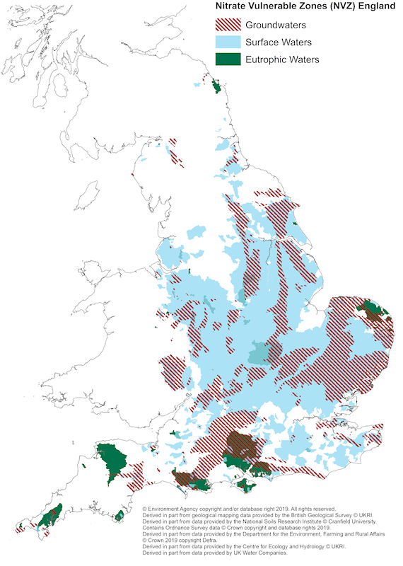
The Nitrate Vulnerable Zones (NVZ) are areas designated as being at risk from agricultural nitrate pollution.
These NVZ’s 2017 pre appeals designations are the NVZ boundaries which apply from January 2017, but are subject to appeals.
© Environment Agency copyright and/or database right 2019. All rights reserved. Derived in part from geological mapping data provided by the British Geological Survey © UKRI. Derived in part from data provided by the National Soils Research Institute © Cranfield University. Contains Ordnance Survey data © Crown copyright and database rights 2019. Derived in part from data provided by the Department for the Environment, Farming and Rural Affairs © Crown 2019 copyright Defra. Derived in part from data provided by the Centre for Ecology and Hydrology © UKRI. Derived in part from data provided by UK Water Companies.
| Title | Nitrate Vulnerable Zones - England |
|---|---|
| Source | Environment Agency |
| Enquiries | data.info@environment-agency.gov.uk |
| Scale(s) | 1:50k |
| Coverage | England |
| Format | GIS polygon data |
| Price | Free for use through Open Government License with attribution statement |
| Uses | Local to national level use |
| UKSO map viewer | View in UKSO Map Viewer |
| WMS | https://map.bgs.ac.uk/... |
| Image(s) | High resolution |
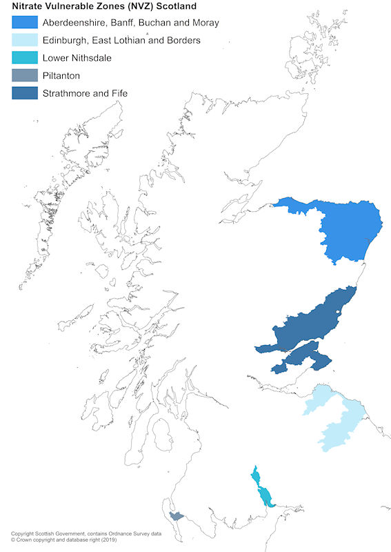
In 2016, five areas of Scotland were designated as NVZs. The five NVZ areas were designated as nitrate levels from agricultural sources either resulted, or would likely result, in a concentration equal or exceeding 50mg/l of nitrates in either surface water or groundwater. The five areas within Scotland, currently designated as NVZs, are: Aberdeenshire, Banff, Buchan and Moray, Strathmore and Fife, Stranraer Lowlands, Edinburgh, East Lothian and Borders, and Lower Nithsdale.
© Copyright Scottish Government, contains Ordnance Survey data © Crown copyright and database right (2019).
| Title | Nitrate Vulnerable Zones - Scotland |
|---|---|
| Source | Scottish Environment Protection Agency |
| Enquiries | SSDI.Metadata@gov.scot |
| Scale(s) | 1:50k |
| Coverage | Scotland |
| Format | GIS polygon data |
| Price | Free for use through Open Government License with attribution statement |
| Uses | Local to national level use |
| UKSO map viewer | View in UKSO Map Viewer |
| WMS | https://map.bgs.ac.uk/... |
| Image(s) | High resolution |
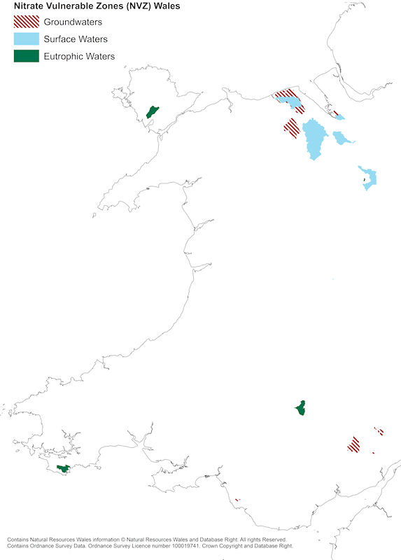
The Welsh Government is responsible for maintaining and improving the quality of the aquatic environment, and carries out a review of the NVZ areas every four years.
Contains Natural Resources Wales information © Natural Resources Wales and Database Right. All rights Reserved. Contains Ordnance Survey Data. Ordnance Survey Licence number 100019741. Crown Copyright and Database Right.
| Title | Nitrate Vulnerable Zones - Wales |
|---|---|
| Source | Natural Resources Wales |
| Enquiries | opendata@naturalresourceswales.gov.uk |
| Scale(s) | 1:50k |
| Coverage | Wales |
| Format | GIS polygon data |
| Price | Free for use through Open Government License with attribution statement |
| Uses | Local to national level use |
| UKSO map viewer | View in UKSO Map Viewer |
| WMS | https://map.bgs.ac.uk/... |
| Image(s) | High resolution |