Select an option from the list below to view high resolution images and data about soils across Great Britain.
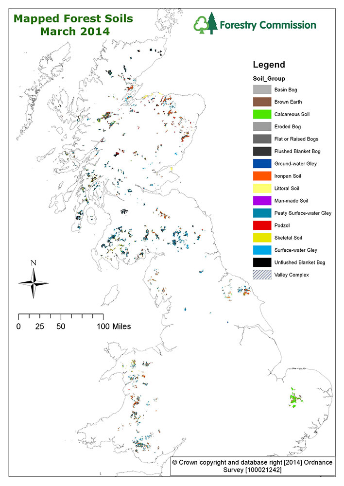
The National Forest Estate soil maps provide detailed soil type information for parts of the Public Forest Estate within England, Scotland and Wales.
The Forestry Commission (FC) soil classification system, listed by Pyatt (1982), is the one most commonly used in forest soil survey work; by foresters, forest managers and within FC publications and was specifically constructed to serve silviculture, distinguishing soils on the basis of drainage and nutrition. This system was used within the Ecological Site Classification (ESC): a PC-based decision support system for British Forests. Inevitably, the FC soil classification system has evolved since its conception; some soil types have been removed, others introduced. A Key to the current soil codes is included in the download data, but a version is also included at the end of this document (Appendix 1). For a more detailed explanation of the FC soil classification system, see the FC Field Guide – The Identification of Soils for Forest Management (Kennedy, 2002).
These data are derived from the digitisation of historic paper-based survey maps, produced by soil surveyors. The FC soil classification system can be applied to other, non-FC soil nomenclature or used to describe soils on site. This digitisation process is complete for Scotland and captures most of the former FC land in Wales. But only parts of England have been captured so far. Other maps for England are known to exist and it is hoped they will be added soon. It is also necessary to state that soil survey data are not held for all of the FC land holdings.
hese data are delivered under the terms of the Ordnance Survey End User Licence. Any maps produced using this data should contain the following Forestry Commission acknowledgement: "Contains, or is based on, information supplied by the Forestry Commission. © Crown copyright and database right [Year] Ordnance Survey [100021242]".
The vector map provides detailed (1:10 000) soil type information for parts of the Public Forest Estate within England, Scotland and Wales. A single Great Britain version is also available.
The main Soil Groups are given and for most polygons, a lower level of Soil Type is also provided. Additionally, for each spatially mapped polygon, up to 3 different soils may be identified and their percentage occurrence within that unit specified. Whilst the soil codes and percentage values are provided for all three potential soils identified within a single polygon, only the primary soil type is identified by name.
The FC soil classification allows for additional descriptive information about the main soil types. For example, whether a soil has previously been cultivated, is extremely stony, loamy, indurated or podzolic. These are known as Phases and are added to the soil code using a suffix. The Full_string field included in the data provides a detailed, single code for each mapped unit which includes the soil type and any phases for all of the soils (up to 3) identified within a single polygon.
| Title | National Forest Estate soil maps (England, Scotland, Wales) |
|---|---|
| Source | Forestry Commission & Natural Resources Wales |
| Enquiries | mapping.geodata@forestry.gsi.gov.uk |
| Scale(s) | 1:10 000 vector |
| Coverage | Parts of the Public Forest Estate throughout Great Britain |
| Format | ESRI shapefile |
| Price | N/A |
| Uses | Local to national level use |
| Map Viewer | View in UKSO Map Viewer |
| WMS link | https://map.bgs.ac.uk/... |
| Images | High resolution | low resolution |