Select an option from the list below to view high resolution images and data about soils across Great Britain.
Users of the UK Soil Observatory and the mySoil mobile app are engaging in citizen science to build up a community soils dataset. They are crowdsourcing information about the soil properties in their area, sending photographs and measurements to gather vital new information on soil science and helping to improve soil maps of the UK.
Users can provide details of their own soil, indicating their location (via a number of possible methods), send a photograph, provide a description, and send details of soil texture and pH. It is hoped that these crowdsourced records can be used to validate and improve our own data holdings and lead to the creation of new community data products.
So far, over 2000 soil property contributions have been received from this growing community of citizen soil scientists. This citizen science dataset focuses on the United Kingdom, though contains additional observations from across Europe and the rest of the world.
It is hoped that these crowdsourced records can be used to validate and improve our own data holdings and lead to the creation of new community data products.
This work is licensed under a Creative Commons Attribution-NonCommercial 3.0 Unported License.The following acknowledgement must accompany the reproduced UKSO materials: "Contains UK Soil Observatory materials © [2014]".
Traditionally, soil scientists use several field and laboratory-based techniques to identify soil texture including sieving, sedimentation and laser granulometry. There are international standards for describing soil textures in terms of their clay, silt and sand content. This community dataset is based on some simple tips that help identify soil in to six classes:
It is hoped that these crowdsourced records can be used to validate and improve our own data holdings and lead to the creation of new community data products.
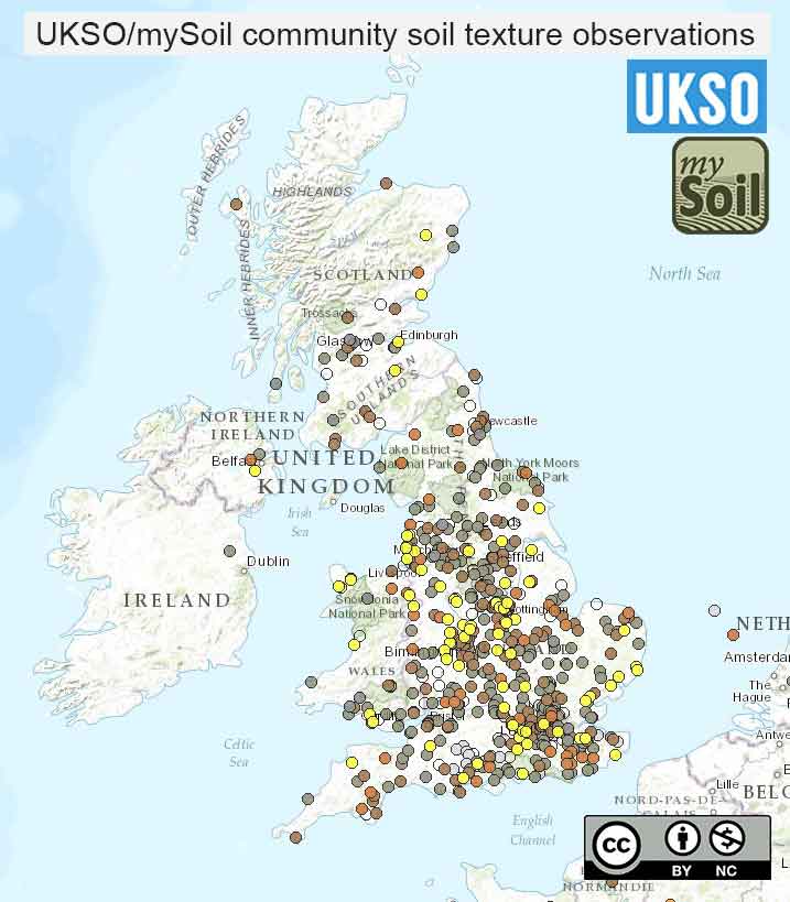
| Title | Community soil texture observations |
|---|---|
| Source | UKSO and mySoil user community |
| Enquiries | enquiries@bgs.ac.uk |
| Scale(s) | Point data |
| Coverage | Great Britain (with some European and worldwide data) |
| Format | GIS spatial point data |
| Price | Data is free for none commercial purpose via the mySoil app |
| Uses | Local to national level use (with some European and worldwide data) |
| Map Viewer | View in UKSO Map Viewer |
| WMS link | https://map.bgs.ac.uk/... |
| Images | High resolution | low resolution |
Testing the pH of your soil is fairly easy to do. It does require a simple kit that you can buy from hardware stores or garden centres. Each kit will come with its own instructions that will guide you through the process of sampling and testing.
Your testing kit will tell you a pH on a scale from 1 (very strongly acidic) to 14 (very strongly alkaline). Most soils fall in the pH range 3 to 9. Choose the closest value from our pH ranges that matches the value shown by your kit.
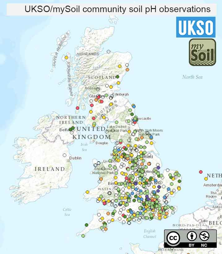
| Title | Community soil pH observations |
|---|---|
| Source | UKSO and mySoil user community |
| Enquiries | enquiries@bgs.ac.uk |
| Scale(s) | Point data |
| Coverage | Great Britain (with some European and worldwide data) |
| Format | GIS spatial point data |
| Price | Data is free for none commercial purpose via the mySoil app |
| Uses | Local to national level use (with some European and worldwide data) |
| Map Viewer | View in UKSO Map Viewer |
| WMS link | https://map.bgs.ac.uk/... |
| Images | High resolution | low resolution |
Points on the map indicate locations where photographs have been taken. Links through to access the photographs are provided.
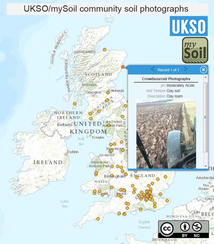
| Title | Community soil photographs |
|---|---|
| Source | UKSO and mySoil user community |
| Enquiries | enquiries@bgs.ac.uk |
| Scale(s) | Point data |
| Coverage | Great Britain (with some European and worldwide data) |
| Format | GIS spatial point data |
| Price | Data is free for none commercial purpose via the mySoil app |
| Uses | Local to national level use (with some European and worldwide data) |
| Map Viewer | View in UKSO Map Viewer |
| WMS link | https://map.bgs.ac.uk/... |
| Images | High resolution | low resolution |